Watershed Management for Natural Resource Management
Natural resource management has direct relationship with the wellbeing and economic of the region. Hilly areas characterized by undulating topography are affected by land degradation due to high intensity of the rain fall leading to decline in fertility and loss of land productivity. This situation should not be allowed to perpetuate for a long time. Forests provide a protective cover to the land and maintain fertility of the soil, beside ecological influences on the climate of the area. Biotic interference and faulty exploitation of the forest for various purpose lead to depletion of the forest wealth. Forest dwelling communities very often become agents of forest degradation, owing their dependence on the forests for timber wood, fodder for the animals and other potential reasons. With this background, the joint forest management (JFM) was initiated by the forest department but the relationship between the forests, forest dwellers and the Govt. authorities has not been congenial and created certain problems. The government is protecting the forest for revenue generation and alienating the people living around the forest in any form of involvement. The local population has not given opportunity in promoting the forest conservation, even though so much is being talked about joint forest management.
Maniyar Gad Watershed Development Project, Tehri Garhwal
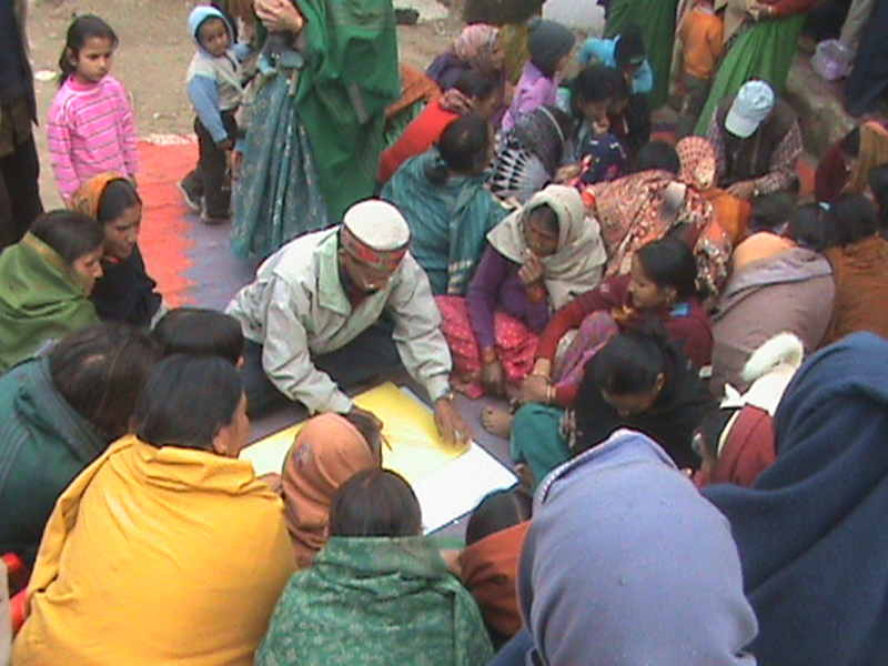
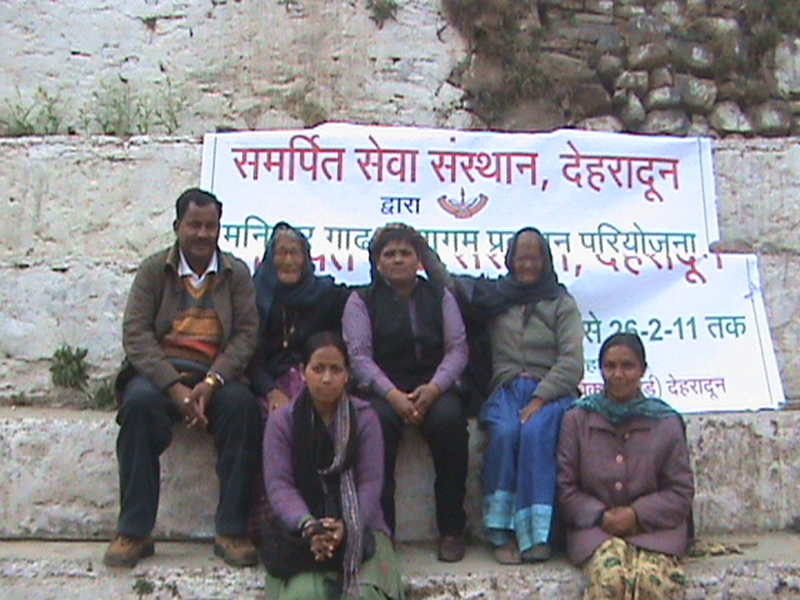
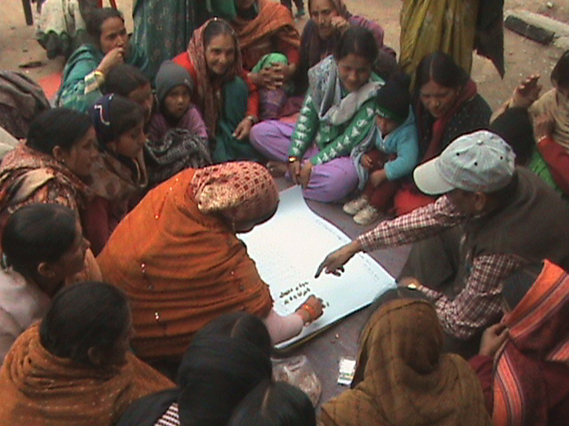
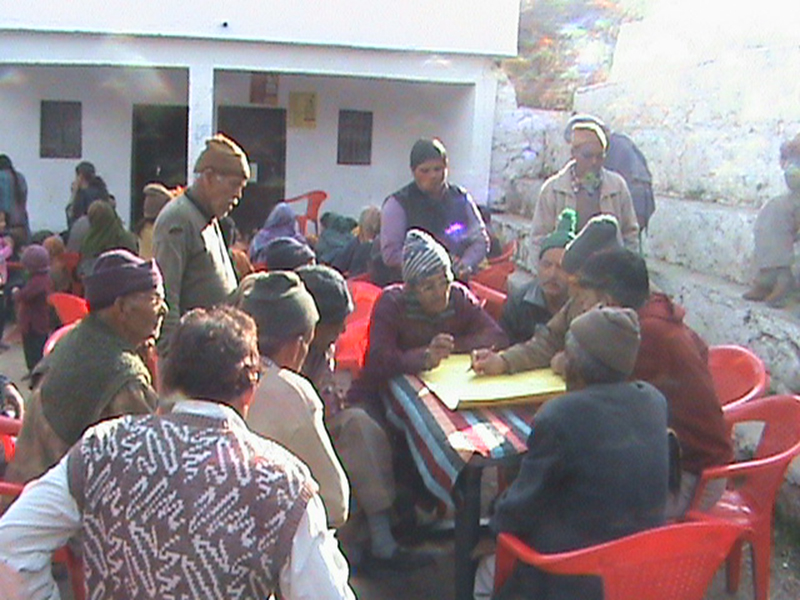
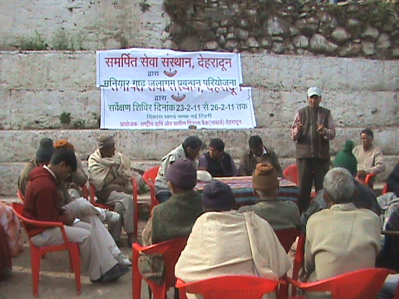
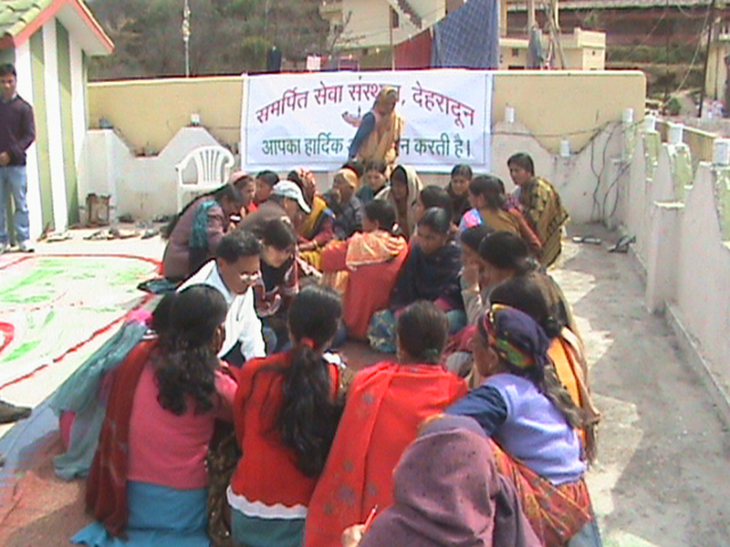
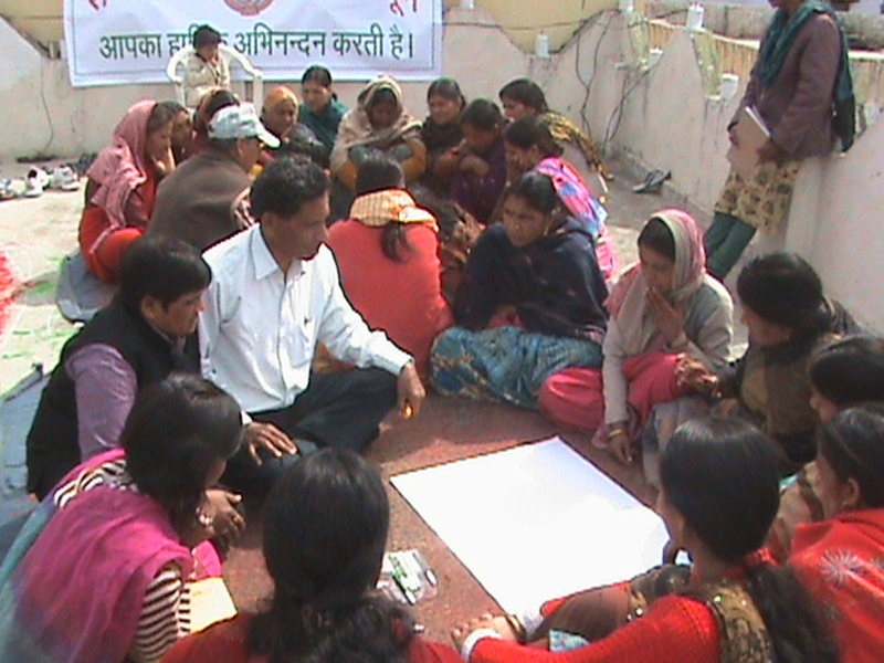
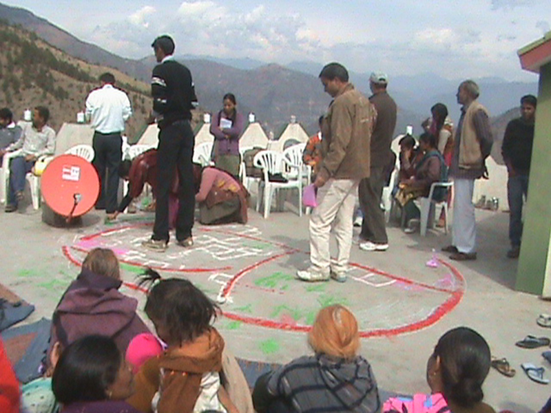
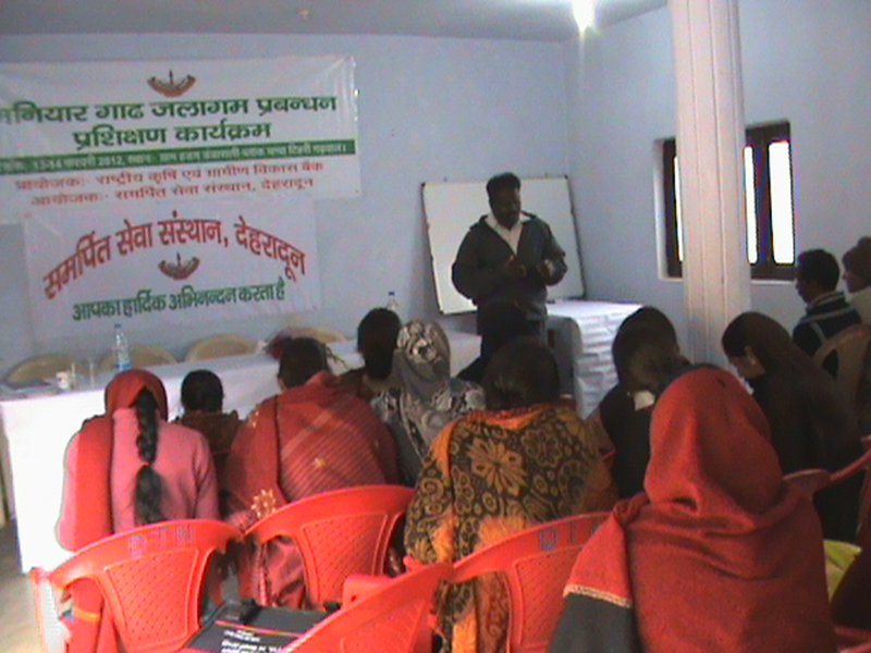
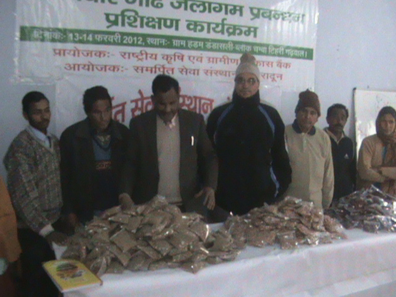
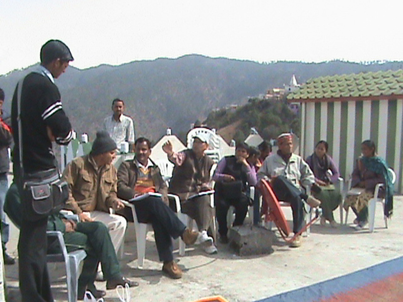
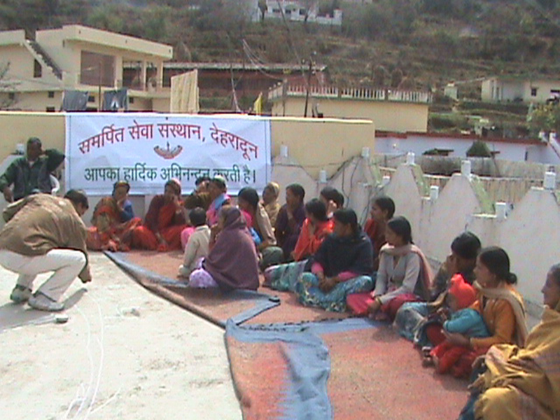
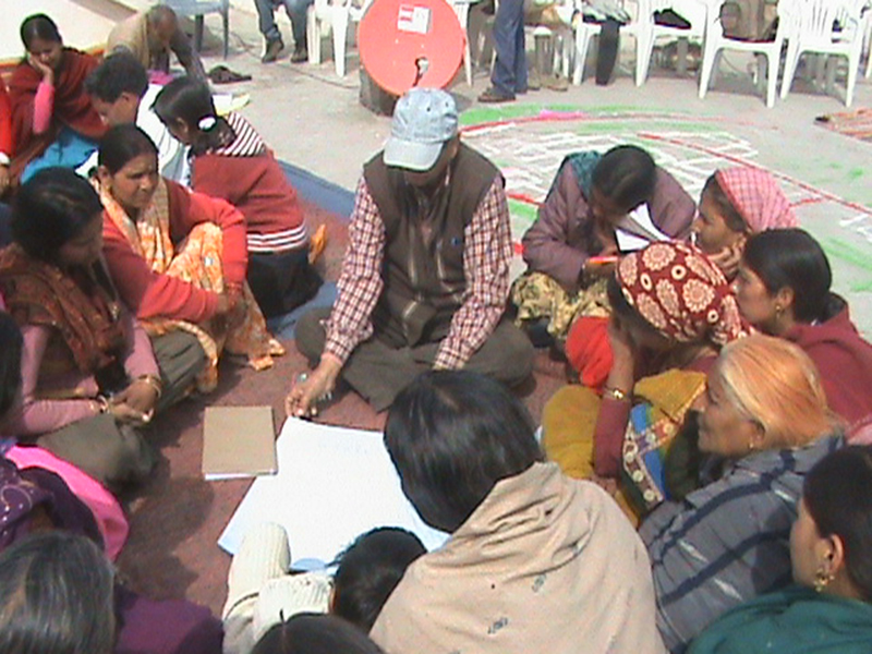
Maniyar Gad Watershed Development Project Distt. Tehri Uttrakhand was approved by the funding agency National Bank for Agriculture and Rural Development, Govt. of India (NABARD) during 2011-2012. Watershed covered 12 revenue villages. In the first phase, two villages, namely Haddam Malla & Guldi were selected for the purpose of capacity building of the beneficiaries. Accordingly, Samarpit Sewa Sansthan launched a Capacity Building Program (CBP) in these two villages from Jan. 13, 2012. The program was formulated taking into account the characteristic need, socio-economic status of the community and the watershed attributes.
Capacity Building Activities
Capacity Building Program consisted of essentially introducing the watershed development program to the participants by the Sansthan as a facilitator and the members of the community functioning as stakeholders in this voluntary activity. In the initial stage as per the NABARD guidelines, physical works were carried out in two selected villages i.e. Guldi and Haddam Malla Guldi is a relativity bigger village with 127 families. Only eight families belong to scheduled caste and remaining 119 families are general caste. Haddam Malla has 35 families, all representing the general caste.
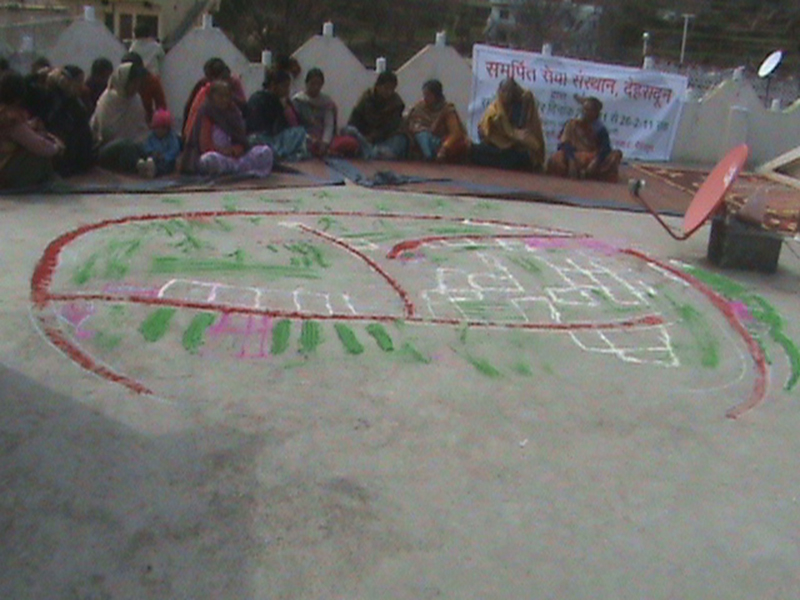
Major land use in these two villages is agriculture, representing cultivable land (99.35ha), irrigation land (5.65ha) and unirrigated land (91.928ha). Barren (7.687ha), pasture (23.187ha) and not fit for agriculture (1.77ha) are other major land uses. Based on need and priorities of the community for natural resource conservation, relevant interventions were planned and carried out in the Maniyar Gad micro watershed during the period of report. Rural community during PRA exercise inhabiting the watershed assigned priority no. 1 to protection of land against erosion and halting expansion of neighboring nalas, so as to ensure safe disposal of heavy flows of rain water. On the basis of engineering survey of the nalas and gullies, suitable treatments were imposed in the form of loose boulder check dams and gabion structures at suitable sites (angle and spacing) in the nala course.
Agriculture constitutes the backbone of rural economy of the hilly region. Maniyar Gad micro watershed has substantial area under cropping which is carried out on the terraced fields. It is noted that the terraces are not properly designed. Outwardly sloping terraces can be seen over larger part of the watershed which invite erosion during heavy rains. Besides, soil fertility is poor and crop productivity is low. In order to amend this situation and provide the people with a sustainable livelihood, ill-designed terraces were leveled and bunded to conserve water and also to dispose off excess water from the field in a safe manner.
Considering water scarcity as a serious problem during summer season, polylined tanks were constructed and wherever sizeable depressions at the falling point of a spring existed, they were dressed up for water storage with minimum earth work to accelerate recharge in springs in lower reaches.
Crop demonstration and subsidiary vocations like poultry were carried out as special intervention to appraise farming community about improved method of cultivation and having poultry as an additional source of income. In order to control erosion, trenching work was carried out on rolling eroded slopes. By means of suitable demonstrations, training in nurturing raising and maintenance of forest nurseries was given to women, to make them potential able contributors to family earnings. Temperate and humid climate of the mid Himalayas is suitable for horticulture and vegetable farming. To start with, grafting technique for propagation of pear and provision of the polyhouses for this propose was made. Besides, training in tailoring, cutting, patch work etc was imparted through planned and systematic course work to women with a view to enable them pursue it later as a means of earning livelihood.
Due to the rapidly eroding traditional practices and increase in population, the natural resources of forests, water resources, agricultural land, grasslands, medicinal plants etc. have degraded considerably. This has led to water scarcity, frequent landslides, heavy soil erosion, low productivity of agriculture and depleted forest. Accordingly, the watershed development project consisting of the following soil and water conservation measures so as to reverse the prevailing degradation of the natural resources was implemented in Maniyar Gad Watershed.
Soil and Water Conservation Measures
- Loose boulder check dams
- Gabion structure
- Field bunding and leveling
- Trenching, afforestation and silvi-pasture
Loose boulder check dams
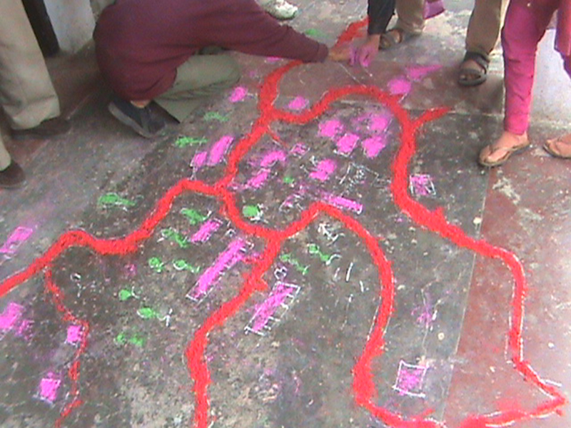
The Maniyar Gad Micro Watershed represents by and large the hydro-geological conditions of the mid Himalayas. It is a settled fact that the erosion initiates from the top reaches in the hilly terrain and the heavy rainfall, which is a common occurrence in the mid Himalayas during monsoons, accelerates soil erosion the land degradation process.
It was seen that undulating topography of the watershed coupled with fragile geology and heavy rainfall created deep gullies, streams and nalas dissecting and criss-crossing the expanse of the watershed. By way of sharing experience of the watershed community. It was revealed that existing gullies and nalas were progressively expanding into valuable crop land on the banks of the streams.
Taking cognizance of the needs of the community and their views, loose boulder check dams (175 cum) were constructed at suitable sites in the course of the streams. In order to minimize the cost of these structures, locally available stone and boulders were utilized and member of the community provided labour and other services by means of their active participation. Latest monitoring of the performance of these structures has shown that they are quite stable and efficient in protecting the adjoining 8-10ha of agriculture land.
Gabion cross barriers
Drainage Line Treatments (DLT) have been found efficacious for channelizing the wild and turbulent flows in the stream, commonly experienced in the watershed streams. One of the effective drainage line treatments for checking the menace of erosion consists of gabion structures in wire net enclosures.
It is observed that moderately sloping sections of the watershed. The streams have a tendency to attain flash flows and in this process large. Accordingly, 19 Nos. (236 cum) of gabion cross barriers have been constructed to channelize the flows and protect adjoining agricultural land.
Field Bunding and Leveling
In the Maniyar Gad Micro Watershed, hill slopes have been converted into terraces of varied shapes and sizes for the purpose of crop cultivation. Generally terraces are outward sloping and these from lot of soil and water is lost as run off during heavy showers in monsoon season. The field hardly conserves water in observe of proper field bunding. Thus soil is depleted of inexpensive nutrients and fertility. Rill formation observed on sloping and ill-maintained terraces, is a signal to impending degradation, while they present impediment to cultural operation for crop husbandry. As impact of the program, the community became aware of the soil and land wasting through apparent water erosion through interaction with the facilitating technical expert. The felt the need to convert erosion into resource conservation. The problem has been controlled by adopting the soil and water conservation measures with the consent of the community 4152 sq m area has been brought under land leveling and field bunding has been carried out over 5000 rm. It is expected impact of the measures would be quite pronounced on soil fertility and crop production.
Trenching, afforestation and silvi-pasture
Barren and degraded forest/pasture land particularly in rugged hilly slopes prone to severe erosion by heavy rain in mid - Himalayan track. Afforestation and pasture development are effective conservation measures in these circumstances. Any other use of these lands is ruled out. To maintain proper moisture regime and arrest sediment generated from steep slopes during heaving rain trenching has recommended in the project. Interception of run off by trenches is instrumental for soil as well as water conservation.
According to description and specification of the intervention, staggered trenching work was carried out in 2.0 ha in vill. Haddam. Napier grass was planted in the trenches along with agro-forestry plantation. In vill.Guldi 2.0ha area has been covered with silvipastural measures with a view to provide fodder availability to livestock, particularly during lean season. It was noted that water conserved in trenches significantly boosted growth of the grass and other local vegetation.
Water recharge Measures
In Maniyar Gad Watershed one of the priorities indicated during the course of interactions with the community concerned revival of the water springs, which were active till a few years ago. Accordingly, 50 recharge pits of the 1mx1mx1m dimension have been dug out in vill. Haddam and Guldi, mainly in pasture and agricultural land. It has been observed that water is stored in these sits is gradually recharging the profile. In course of time, it is expected that water recharge will nourish the dry spring. Growth of the grass near the pits is dense due to better moisture regime. Taking advantage of the favorable soil moisture status, lemon saplings have also been planted near the recharge pits in these villages. It is most gratifying that survival of lemon has been at 90% due to increased regain around the recharge pits.
Construction of the Chaal
By Chaal in local parlance means a naturally occurring depression in the upper hill reaches, having promise to be used for water storage as well as recharge after dressing it up with minimum earth work for this propose.
Accordingly, four Chaals were developed at suitable sites, in the Maniyar Gad Watershed and dressed up with bare minimum earth work. Till date, these Chaals have filled with seasonal showers 4 times and further observation show that the stored water has found gradual entry in the profile for recharge purpose.
Pond structure for water harvesting(Sub Surface Water)
The need is to organize the local population for the conservation and management of nature and natural resources on the line of watershed management approach. The projects are giving us good opportunity in understanding the dynamics of inter linked bond between the nature and the local population. The program activities are watershed management and natural resource development, ecological farming, forest conservation and biodiversity, are essential and integral part for development of a rural society. Keeping in the above mentioned problems in view watershed management program was initiated in Sahaspur Block supported by CAPART. Under this program problems of low crop productivity, soil erosion and land degradation, lack of water resources, almost no access to improved techniques and lack of community participation where indentified as major areas to be addressed on priority. Some of the majors solutions to these problems are illustrated as follows:
Gabion Structure to streamline turbulent flows and protect land against erosion


Retaining wall to provide protection against severe degradation